



Winter Farm Planning: A Rock and Weed Checklist Before Spring 2027
The combine is parked and the repair bills are on the desk. That makes now the right time for winter farm planning. The calls you make between now and March decide where your crew spends its spring hours and how much chemical goes in the tank on your second pass.
This guide walks through the winter decisions that touch rocks and weeds, what information each one needs, and where a TerraClear Rock Map or TerraClear Weed Map fits.
Key takeaways
- Winter farm planning is when you set spring crew, hours, field order, and your herbicide program. Those calls are cheaper to make on paper than in the field.
- Last fall’s rock damage tells you which fields to deal with first. Frost heave will push up new rocks over the winter, so the map you use should fly right before planting.
- Plan your 2027 herbicide program with multiple effective herbicide groups, then plan a targeted second pass sprayed only where weeds are.
- TerraClear has limited Weed Mapping slots available this year. Buying map acre credits in winter lets you choose fields and flight timing later.
What is winter farm planning?
Winter farm planning is the work you do between harvest and spring to set next season’s plan: which fields get attention first, who is on the crew, what equipment needs fixing, and what crop protection program you’ll run. For row crop and small grain operations, two of the biggest swing factors are rocks and weeds. Both cost time and money in the spring, and both are easier to manage when you know where they are before you roll.
Margins make the planning matter. The farmdoc 2027 Illinois crop budgets put corn break-evens just under $5.00 a bushel in northern and central Illinois, with projected returns of $28 to $36 an acre. USDA cost projections reported by Farms.com show total production costs heading toward record highs for most major crops in 2027. There isn’t much room for a wasted pass or a broken header.
What should be on your winter farm planning checklist?
Start with the decisions that are hardest to change once spring hits.
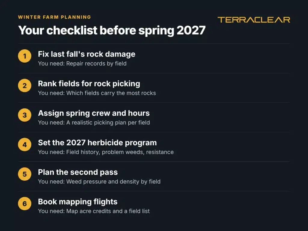
| Winter decision | What you need to make it | When it pays off |
|---|---|---|
| Fix last fall’s rock damage | Repair records by field | Before planting |
| Rank fields for rock picking | Which fields carry the most rocks | Spring field work |
| Assign spring crew and hours | A realistic picking plan per field | Planting window |
| Set the 2027 herbicide program | Field history, problem weeds, resistance | Burndown through second pass |
| Plan the second pass | Weed pressure and density by field | Post-emergence |
| Book mapping flights | Map acre credits and a field list | Before planting and before the second pass |
The sections below take these one at a time.
How do you plan rock picking before spring?
Start with last fall. Pull the repair tickets and note which fields did the damage. Those fields go to the top of the list.
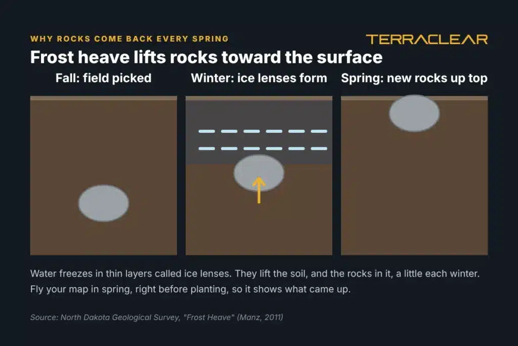
Then plan for what’s coming. Rocks keep showing up in fields you picked clean because of frost heave. The North Dakota Geological Survey explains that ice lenses form in the soil as it freezes, lift the ground, and carry stones up with it. Fine-textured glacial silts and loams, common across the northern plains, are the most prone to it. So a rock map flown last fall won’t show what the winter brings up. The map you pick from should fly in spring, once the ground is open and before planting.
Here’s how a winter rock plan comes together:
- List your rockiest fields from repair records and crew memory.
- Decide who picks. Your own crew can pick from a TerraClear Rock Map, or TerraClear can connect you with an independent rock picking operator.
- Buy map acre credits for the fields you’ll map. You pick exact fields and flight timing later.
- Fly before planting. The map lands in the TerraClear app the next day on average, with a precision plan (the field-by-field action list that comes with your map) and a pick route.
- Pick from the route, densest fields first.
Wayne Drangshol of Mohall, North Dakota, described the old way plainly: “Each spring, I relied on memory from the previous fall to recall where rocks had been identified, then spent valuable time driving fields in search of those locations.”
Jacob Ebeling, who farms in Minnesota, uses the map to set the order: “The map lets me plan my day out. I can target the fields that are the most dense.”
For more on timing, see our guide to fall rock mapping and how to choose GPS for rock picking.
How much can one rock cost you?
More than most people budget for. Flaman, a Western Canada equipment dealer, notes that a rock through a combine used to mean “a few hundred to maybe a couple thousand” in damage. With today’s faster, higher-capacity machines, repairs can run “tens of thousands of dollars.”
The damage also spreads. In AgWeb, Dan Anderson lists feeder house chains, concave linkages, sieves, chopper housings, and grain augers as places a rock can do harm after it gets past the header. He also notes that insurers often want rock damage claims within six weeks of the end of harvest.
Machinery is already one of your biggest line items. Purdue’s machinery cost benchmarks put 2024 machinery costs at $178 an acre for corn and $108 for soybeans on farms over 1,000 acres. Unplanned rock repairs sit on top of that.
David Holte put the math in one line: “If this saves you from hitting a rock with a chopping corn head, it has paid for itself.”
How do you plan your 2027 herbicide program in winter?
Your chemical program gets set this winter, usually with your agronomist or retailer. Iowa State weed scientists Meaghan Anderson and Bob Hartzler recommend building it around multiple herbicide groups that are effective on your target weeds, starting from field history and any signs of declining control.
That advice has teeth. Waterhemp is now confirmed resistant to seven herbicide sites of action, according to Crops & Soils. Purdue’s Bryan Young told the magazine a second residual should go down before the first one breaks.
A winter herbicide plan should cover:
- Problem weeds by field, and any resistance you’ve seen or confirmed
- Residual layering so one residual overlaps the next
- Effective post-emergence options for each field
- How you’ll spray the second pass: broadcast across the whole field, or targeted to the acres that carry weeds
That last line is where a TerraClear Weed Map fits. To see what targeted spraying costs, read herbicide cost per acre.
Where does a TerraClear Weed Map fit in winter planning?
A TerraClear Weed Map flies before your second pass, so in winter you aren’t looking at weed data yet. You’re booking the flight and shaping the plan around it.
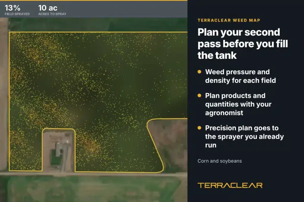
When the map comes back, it shows which acres carry weeds, down to 1/4″, with weed pressure and density for each field. You and your agronomist can use that to choose products and set quantities. The precision plan goes to the sprayer you already run, and it’s compatible with the most commonly used controllers and monitors in North America, including John Deere, AgLeader, and CaseIH. You can also fill the tank for what the field needs before you leave the yard, which a camera sprayer can’t tell you ahead of the pass. More on that in targeted spraying without a new sprayer.
A TerraClear Weed Map can help you use up to 80% less herbicide with the same control. TerraClear Weed Maps work in corn and soybeans, and stand counts come with every map.
Isaak Brown, of Brown Harvesting in Devils Lake, North Dakota, put the case plainly: “The thing I like about the Weed Map is that every farmer has weeds. People can’t successfully farm without taking care of their weeds.”
TerraClear has limited Weed Mapping slots available this year. If a targeted second pass is part of your 2027 plan, booking credits in winter is how you hold a spot.
How do map acre credits work for winter planning?
You buy map acre credits now and decide the details later. Here’s the order:
- Buy map acre credits online or in the TerraClear app.
- Pick your fields and flight time once your spring plan is set.
- Every acre gets flown. TerraClear maps the whole field, not a sample.
- Put the map to work. Hand your crew the pick route, or send the weed precision plan to your sprayer.
Each checkout is for either Rock Maps or Weed Maps. Step-by-step instructions are in how to order Rock and Weed Maps for 2027.
What do farmers say after planning with a map?
TerraClear has mapped millions of acres across over thousands of farm operations, according to TerraClear. Farmers find about 3x more rocks and pick about 3x faster with a TerraClear Rock Map.
Travis Voit, of Sauk Centre, Minnesota, saw it in fields he thought were done: “One of the biggest eye-openers with TerraClear rock mapping was seeing the rocks it found during post-plant flights in fields we had already picked by driving every pass.”
Michael Rostad, of White Earth, North Dakota: “TerraClear is a game changer for picking rocks. Once your field has been mapped, anyone can go efficiently and confidently clear the field.”
Mike and Bill Bechtold, of Velva, North Dakota, said the same about rocks and weeds together: “If there is one thing in our fields that we hate as much as weeds, it’s rocks.”
Right after harvest. Repair records and field notes are fresh, and you have time to line up crew, chemical, and mapping before spring.
Credits let you hold your mapping now and choose fields and flight timing later. By doing so, you can secure the best price available for the season. Additionally, TerraClear has limited Weed Mapping slots available this year.
Right before planting, once the ground is open. That way the map shows rocks that frost heave pushed up over the winter.
Before your second pass. The precision plan is ready for your sprayer the next day on average.
No. TerraClear makes the map. Your crew picks from it, or TerraClear can connect you with an independent rock picking operator.
No. No map catches everything, but TerraClear maps help your farm operate more efficiently. A TerraClear Rock Map marks rocks 8″ and larger at a GPS-pinpointed location, and a TerraClear Weed Map detects weeds down to 1/4″. Farmers using a TerraClear Rock Map find about 3x more rocks AND pick 3x faster.
Corn and soybeans. Stand counts come with every TerraClear Weed Map.
TerraClear maps in Montana, North Dakota, South Dakota, Minnesota, Iowa, Nebraska, Kansas, Missouri, Illinois, Wisconsin, Michigan, Ohio, and Indiana, plus Western Canada.
Ready to plan your spring?
Tell us which fields are on your list. A specialist will help you set up your account and get your acres ready. Or call the TerraClear sales line at (712) 545-7144.

Charles Stover is a Marketing Manager at TerraClear. His marketing career spans 20+ years in broadcast, healthcare, SaaS, and ag tech, with a focus on building and executing award-winning, data-driven campaigns. He’s a University of Oregon School of Journalism grad, a girl dad, and a lifelong Ducks fan. Find him at Charles-Stover.com or on LinkedIn