


Rock Management
More Rocks. Less Time.
TerraClear’s AI-powered rock mapping reveals more rocks, helping you pick more, pick faster and get back to farming.
Turn imagery into precise, field-ready rock maps.
Farmers using TerraClear report 3 times more rocks identified and up to 80% less time spent picking.
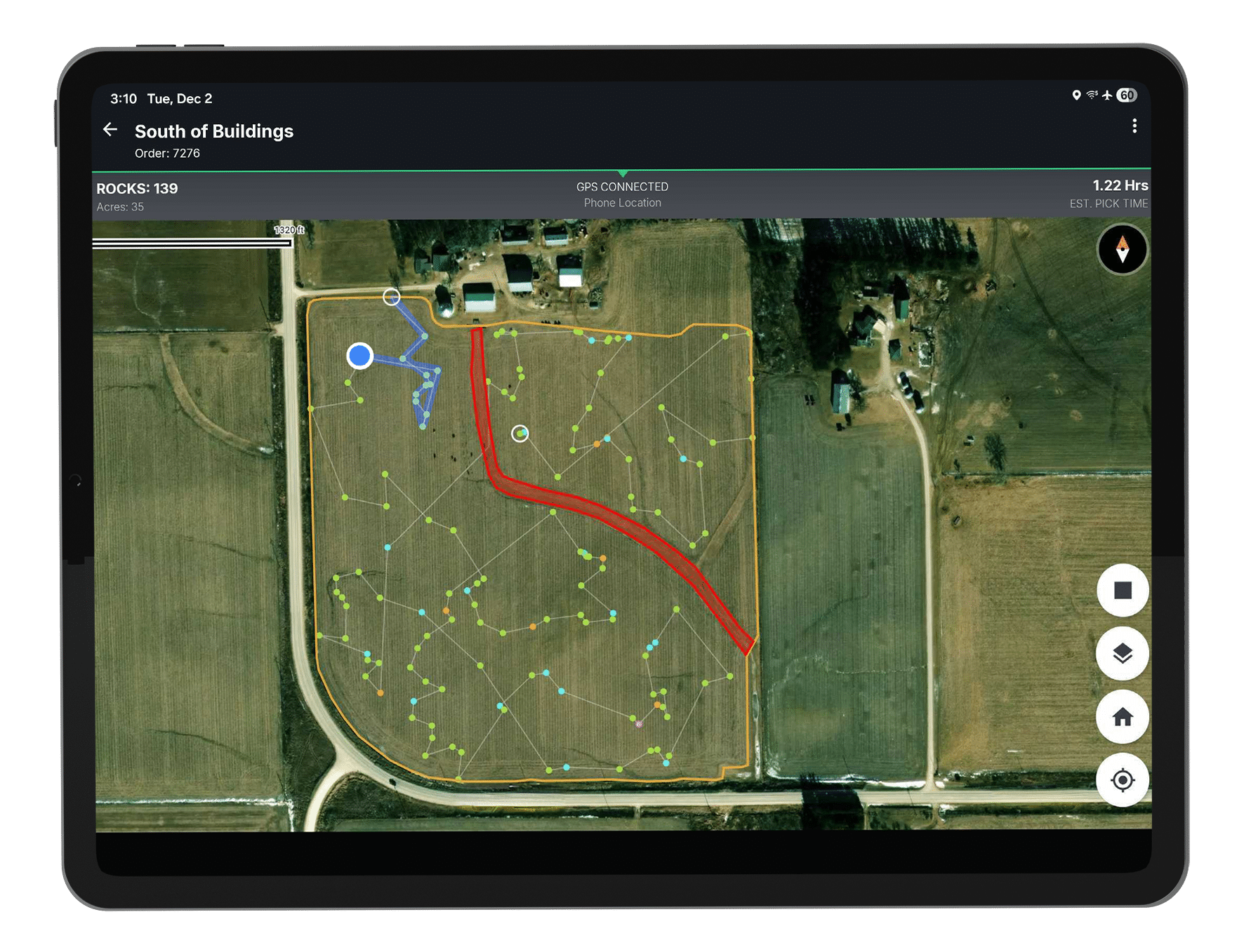
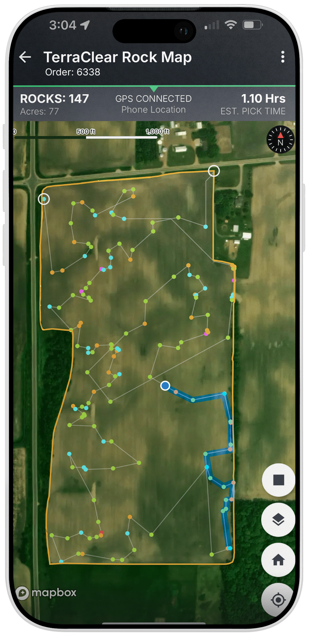


Filter rock sizes to only target the rocks you are worried about
Share rock maps with your staff to ensure they stay on track
Connects to multiple 3rd party GPS devices for more precise execution
From Imagery to Action in Four Steps
TerraClear’s platform combines AI vision, mapping, and machine learning to close the loop from imagery to action.

Full Field High-Res Imagery
At 1.5 mm GSD, an acre consists of ~18 million pixels, each about the size of a pencil eraser.

AI-Generated
Rock Map
TerraClear’s novel AI system accurately identifies rock size and location.

You Pick 3x Faster
Use the rock map to optimize your own rock picking to find 3x more rocks and pick 3x faster.
Full Field Tracking via App
Farm with peace of mind knowing you can track every rock that’s been removed from your field.
Have questions? We’re here to help.
Find answers to the most common questions and what to expect in our resource library.

“The Rock Map has just made rock picking for us so much easier, because it takes less time so we can get across more acres per day.”
Kyle O. | Iowa Farmer
Don’t Want to Pick It Yourself?
If you have received your TerraClear Rock Map and don’t want to remove the rocks yourself, check out these independent service providers.
While TerraClear does not provide rock removal in-house, we have a selection of independent service providers who are ready to help with your rock picking!
Reach out to a service provider using the provided contact info and offer to share your Rock Map. The service provider will then provide you with a quote, utilize your rock map to pick efficiently, and invoice you directly
* Equipment type may vary by service provider
Frequently Asked Questions
Answers to the most common questions about TerraClear’s Rock Mapping.
Any time rocks are clearly visible from the air: after harvest and tillage, after snow melt in spring, or even after crop emergence — as long as the rocks are not covered.
Our system works wherever rocks are visible from above — including fields with stubble, residue, or emerged crops.
We capture high-resolution aerial imagery over your fields, then use AI and computer vision trained on hundreds of thousands of rock images to detect and map every pickable rock down to 8 inches with centimeter-level GPS accuracy.
We reliably detect and map rocks 8 inches and larger.
Use the Share button to invite team members. Learn the difference between Admin and User roles.
To preserve the integrity of your Rock Map, do not work the ground in any way from the time that your field was flown until rock removal is completed.
Each independent service provider sets their own pricing, and factors determining the price include distance traveled to field, field size, rock quantity, plus others. Please discuss directly with your independent service provider.
Every acre has a story. Let’s map it.
Whether you’re ready to map a field or just curious about what’s next, we’ll help you find the right starting point with TerraClear.