


Authorized REseller Program
Put a new margin on
the acres you already cover.
TerraClear turns whole-field imagery into rock and weed maps your growers act on. It’s the kind of field intelligence that sets you apart from the competition and gives customers a reason to stay.
Compete on what you know, not just price.

A new Margin Line
Put a new, ownable margin on acres you already cover, and grow your crop-protection income without moving another gallon.

A Stickier Book
Growers leave over price. They stay for service. The more of a grower’s ground you map, the harder it is for anyone to quote you out of it.

Resell It, Don’t Run It
Compete on precision without hiring a precision team to run it. It is a service your team resells, not another platform they have to run.
Bring your growers every acre, not a spot check.
TerraClear turns whole-field imagery into maps growers act on. The same engine behind rock and weed mapping is expanding across the field.
Available Now
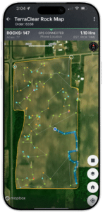
Rock Map
Locate rocks 8″ and larger mapped with GPS-pinpointed location, prioritize by size and use a suggested route so the crew picks 3x faster.
Available Now
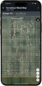
Weed Map + Stand Counts
Whole-field weed density in 10-inch zones, delivered as a precision spray plan the grower’s section-control sprayer runs. Nozzles on for the weeds, off over bare ground. The same flight also returns crop stand counts, accurate through V2 soybeans and V3-V4 corn, with double-plant detection in development.
Coming Soon
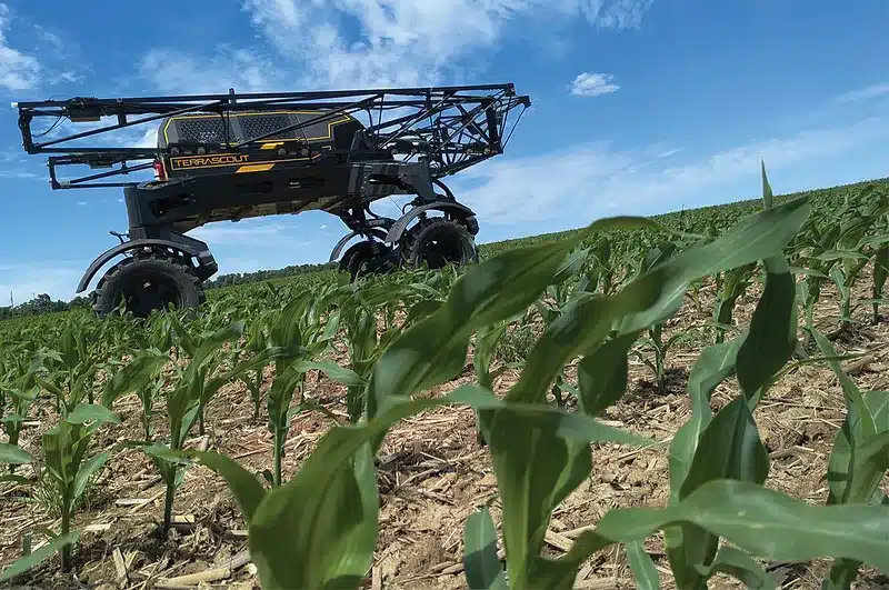
What’s Next
The same field-intelligence engine keeps expanding what you can sell. Coming next:
- Plant Phenotyping
- Pest and disease detection
- Nutrition optimization
More on the way
Same control, less chemical.
Whole-field weed density becomes a precision spray plan for the grower’s section-control sprayer, the growers rate and mix, placed where the weeds actually are. They buy less product up front and leave less in the shed, and you deliver the intelligence that makes it possible.
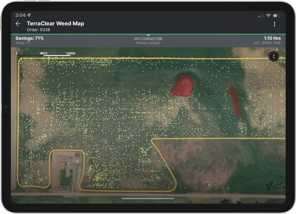
Up to 80%
Less herbacide*
Whole-Field
Coverage
Next Day
Average
*Based on observed averages. Herbicide savings vary by field, weed density, distribution, and sprayer settings.
Two ways to build it into your business.
Resell the mapping or run it yourself. Whichever fits your business, the right path starts with a conversation.
Mapping as a Service
Resell a precision service without running one. Put map acres on your growers’ fields, we fly and map them, and you sell the finished maps under your own book.
How it works
You bring the growers, we bring the flying, processing, and turnaround.
- Finished plan comes back ready to use
- Your team delivers it, not produces it
- No equipment and no added headcount
Hardware+
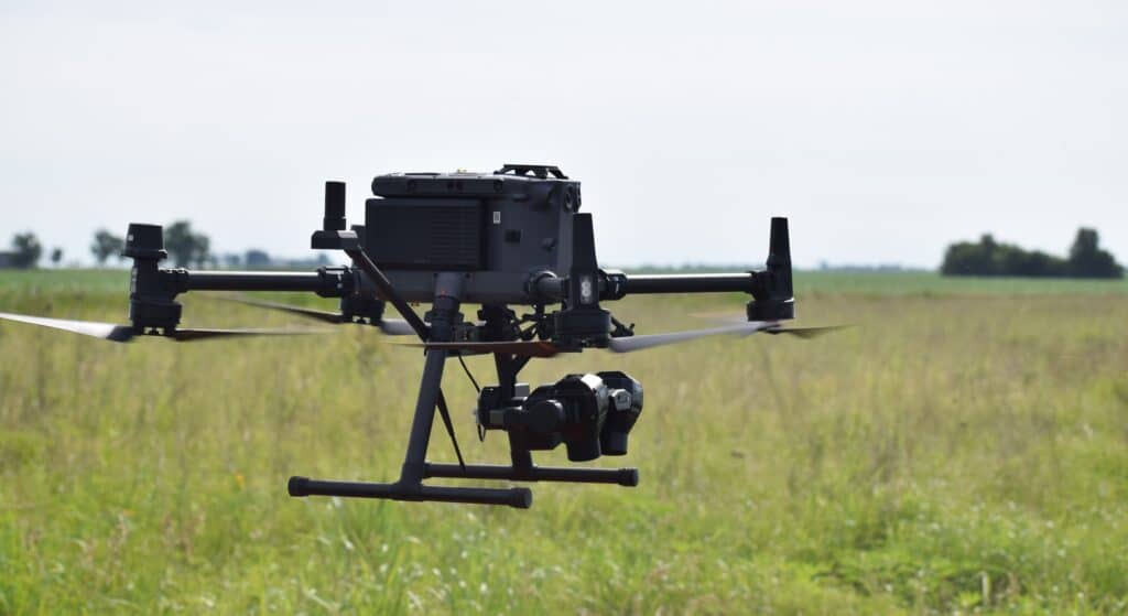
Run mapping in-house and keep the full service margin, not just a markup on someone else’s. This is the path for retailers ready to own the capability across their whole book.
How it works
Your drone. Our processing. A precision plan your grower can run the next day.
- Bring a drone, lease the sensors from us
- Run TerraClear’s detection and on-field processing
- Setup sized to your operation, backed by training and support
Stay the adviser your growers trust.
As resistance makes weed programs less predictable, the retailer who knows where the pressure is stays the one growers rely on.
- Base recommendations on every acre, not just the acres edge.
- Scout the entire field without walking the entire field.
- Make every recommendation defensible, grounded in weed detection down to a quarter inch.
- We map the field. The recommendation stays yours to make.
Program Details
Straight answers on how it works, what you need, and how to get started.
There are two ways in: resell TerraClear mapping across your book, or bring the mapping in-house with your own equipment. The right path depends on your operation. Talk to our team and we will help you find the fit.
Most ag retailers, co-ops, and agronomy businesses with a book of growers in a serviceable territory can qualify. For Mapping as a Service, there is nothing to buy, no hardware and no capex. For Hardware+, you bring your lease or own a drone and can lease or own the sensors from TerraClear. Hardware must meet current TerraClear specifications.
Most modern sprayers with section or individual nozzle control, inside the platforms they already use like John Deere Operations Center. Supported systems at launch include John Deere, AgLeader, and CaseIH, with more to follow. Row spacing at launch is 30-inch and 22-inch.
Rock, weed, and crop stand counts today, all built on the same field-intelligence engine, with more applications on the way.
The next day on average. Maps are processed on-field, not in the cloud, which is what keeps the turnaround fast.
Talk to our team. We assess fit for your book and territory, then align on the right path before moving forward.
Terms depend on the path you choose and the size of your book. Talk to our team and we will walk you through the options.
See how far your acres can go.
There is more than one way to build a precision service on the acres you already cover. Tell us about your operation and our team will help you find the fit.