


Key takeaways
- A phone or tablet works fine with a TerraClear Rock Map. Under open sky, it gets you within about 6 to 20 ft of each rock.
- A dedicated GPS receiver gets you closer, to about 1 ft, and updates your position up to 10 times a second.
- RTK gets you closest. With corrections, the receiver is accurate to about an inch, and the remaining error is mostly the map’s.
- What you see in the field combines two errors: the map’s placement, generally under 1 meter (about 3 ft), and your device’s GPS. The receiver you choose controls the second one.
On this page
- How accurate is GPS for rock picking?
- Where does in-field accuracy come from?
- Is a phone or tablet good enough?
- Why does a dedicated receiver do better?
- Which GPS receiver should you use?
- Why is RTK the best option?
- Where can you get RTK corrections?
- What else affects GPS accuracy?
- Do you need cell service?
- How do you choose the right setup?
- Frequently asked questions
How accurate is GPS for rock picking with a TerraClear Rock Map?
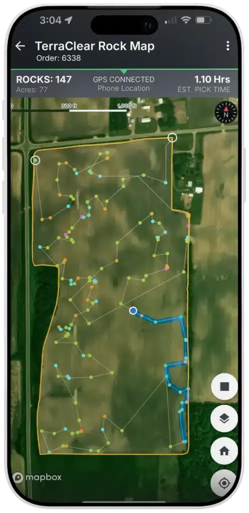
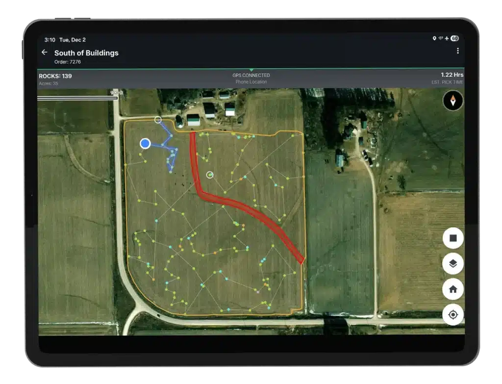
A phone used as GPS for rock picking typically gets you within about 6 to 20 ft of each rock. A dedicated receiver can get you as close as 12″, and RTK within about an inch. The TerraClear Rock Map marks where each rock sits in the field. The GPS in your phone, tablet, or receiver marks where you are. The closer those two agree, the faster you pick.
Manufacturer specs and published research put the three options roughly here:
| Tier | Good: phone or tablet | Better: dedicated receiver | Best: RTK |
|---|---|---|---|
| Typical accuracy | About 6 to 20 ft | As good as 12″ (varies by location) | About 1 in or better |
| Position updates | Usually once per second (1Hz) | Up to 10 to 20 per second | Up to 10 to 20 per second |
| Extra hardware | None | Receiver, plus mount or cable | Receiver plus a correction source |
| Best fit | Low residue, sparse rock | Most fields | Dense rock, heavy residue, any condition |
Treat these as typical ranges, not guarantees. Your own numbers will move with tree lines, terrain, and the location the day you pick.
Where does in-field accuracy come from?
Start with the map. TerraClear flies your field by drone and captures imagery. AI picks out rocks 8″ and larger and tags each one with a precise GPS location. Capturing and stitching that imagery adds a small margin of its own, generally under 1 meter (about 3 ft). Depending on sensor/terrain, TerraClear can provide rock location accuracy <=3′.
Then there’s your device. Its GPS fix is the part you control, and it swings the most. A phone can miss by 15 ft or more. An RTK receiver is repeatable with sub-inch accuracy.
The two add up to what you see from the cab. On a phone, the device is most of the error. On RTK the device error shrinks to almost nothing, and what’s left is the map’s margin, which is small enough that an 8″ rock should be in plain view as you pull up.
Is a phone or tablet good enough for a TerraClear Rock Map?
In a lot of fields, it is. Most farmers start with the phone or tablet they already carry. The TerraClear FAQ is direct about the trade-off: accuracy in the field “is dependent upon your device.”
GPS.gov says smartphones are typically accurate to within a 16 ft radius under open sky, with buildings, bridges, and trees making it worse (GPS.gov). A 2024 Cal Poly test of 13 phones averaged about 10.6 ft of error, with newer dual-frequency phones doing a little better than single-frequency models (Cal Poly). University of Georgia Extension puts smartphone and tablet guidance apps at plus or minus 15 to 18 ft (UGA Extension).
On clean ground with rocks spread out, that’s plenty. The phone puts you in the right area and you spot the rock. Heavy residue and dense patches change that. If you’re 15 ft off and three rocks sit inside the circle, you spend the time hunting instead of picking.
Phones also update slowly, usually once a second, and some models lag when cell service is weak.
Why does a dedicated GPS receiver do better?
It has a better antenna and chip than a phone. The receiver pairs with your phone or tablet over Bluetooth or a cable, and the app uses its position instead of the built-in one. Most receivers also pull free satellite corrections (WAAS in North America) to tighten the fix.
Receivers update faster, too. At common picking speeds, this is how far you move between position updates:
| Speed | Gap at 1Hz (most phones) | Gap at 10Hz (receiver) |
|---|---|---|
| 3 mph | 4.4 ft | 5 in |
| 5 mph | 7.3 ft | 9 in |
| 8 mph | 11.7 ft | 14 in |
Update rate has nothing to do with how accurate each fix is. What it changes is how well the blue dot keeps pace with the machine. At 10Hz the map turns when you turn, so you aren’t waiting on it as you swing toward the next rock.
Which GPS receiver should you use with your Rock Map?
Three receivers work with the TerraClear Mobile app. Any of them beats a phone, and the right one depends mostly on whether you run Android or iOS and what’s already on your equipment. They’re listed from the best all-around fit to the most situational.
First, update TerraClear Mobile to version 3.4.0 or later. That release added support for external receivers.
1. John Deere StarFire receiver
A StarFire already on your tractor or sprayer may be the best receiver you could use. On the free SF2 signal, Deere lists pass-to-pass accuracy of plus or minus 6″ (15 cm) (John Deere StarFire 7500). The position holds steady without lag, and it keeps up with quick direction changes in dense rock.
It only works with Android, not iPhone or iPad. It also takes some setup: a mounting spot, power, and a stand-alone harness with RS232 output, such as the Ag Express AE3070P, which is listed for StarFire 3000 and 6000. Add an RS232-to-USB-C adapter and a USB-C splitter so the tablet charges while it reads the receiver. On a StarFire 7000 or 7500, check harness fit with TerraClear support or your dealer.
2. Columbus P-70 Ultra
The Columbus P-70 Ultra delivers high-quality GPS with no fees or subscriptions. It’s a small dual-band receiver on a magnetic antenna, so moving it from the pickup to the loader takes seconds. The manufacturer lists about 1 ft (30 cm) accuracy with free satellite corrections and update rates up to 20Hz. For picking, 10Hz is the smoothest setting.
The manufacturer lists it for Android 10 or later. It has no internal battery and runs on USB power, so you’ll need a power source in the cab. Connecting it to your Rock Map takes a few minutes; the P-70 Ultra setup video walks through it.
3. Juniper Systems Geode
For iPhone and iPad users, the Juniper Geode is the one to look at. It works with both iOS and Android, runs all day on its battery, and mounts with a magnet. Juniper lists about 1 ft (30 cm) accuracy with free satellite corrections.
Out of the box, the Geode updates at 1Hz. The 10Hz and 20Hz rates and multi-frequency tracking are paid upgrades from Juniper, and 10Hz makes a real difference while picking, so ask Juniper which options you need before you buy. Juniper sells single-frequency and multi-frequency models, and the multi-frequency one is built for RTK.
Why is RTK the best GPS option for picking rocks?
RTK (real-time kinematic) checks your receiver’s position against a base station at a known location and corrects it, down to about an inch. Oklahoma State University Extension rates RTK at about 1 inch pass to pass, repeatable year to year, within roughly 12 miles of a base (OSU Extension).
With RTK, your device stops being the weak link. What you see in the cab is close to the map’s own placement. RTK gives the best experience in every field condition, and you’ll notice it most in heavy residue and dense rock.
Each of the three receivers can run RTK. A StarFire uses SF-RTK, which comes by satellite with no base station, or RTK Radio, or Mobile RTK over cellular. Deere lists those at plus or minus 1 in (2.5 cm) pass to pass, and your John Deere dealer handles activations. The P-70 Ultra has an RTK mode that takes corrections streamed over the internet (a method called NTRIP) through your phone or tablet’s data connection. The manufacturer lists it at 1 cm plus 1 part per million of the distance to the base, which is under an inch near the base. The Geode does the same over NTRIP once you add its RTK upgrade.
Where can you get RTK corrections in the Midwest and Plains?
Several state transportation departments run free RTK networks farmers can use. You register, get a login, and point your receiver at the network.
- Minnesota’s MnCORS is free with registration and has mountpoints set up for ag equipment.
- The Iowa Real Time Network is free, with stations reaching into Minnesota, Wisconsin, and Missouri.
- The MoDOT GPS network in Missouri is free with a signed user agreement.
- Indiana’s InCORS is free with a user agreement.
- Michigan and Ohio run state networks too. Wisconsin and Montana have them, with access terms that vary.
In the Dakotas, Nebraska, Kansas, and Illinois, your equipment dealer’s RTK network or a subscription service is the usual route. GPS World keeps a list of public RTK networks by state.
Network RTK needs cell service in the field. On a quarter with spotty coverage, satellite-delivered corrections like SF-RTK don’t depend on it.
What else affects GPS accuracy in the field?
A good receiver can still get a bad fix. The cab itself blocks signal, so a receiver sitting on the dash does worse than one up top. University of Tennessee Extension recommends mounting the antenna on top of the machine along its centerline (UT Extension). Near tree lines and buildings, signals bounce, and the fix gets worse along field edges and around the yard.
Space weather can throw you off too. The May 2024 geomagnetic storm threw off GPS guidance across the Midwest, RTK systems included (Agriculture Dive). If your fix looks wrong for no obvious reason, check NOAA’s Space Weather Prediction Center.
On a phone, a weak cell signal or an older device can also add lag.
Do you need cell service to use a Rock Map in the field?
Not for position, if you run an external receiver. A receiver like the P-70 Ultra supplies the GPS fix, so you don’t need a cellular tablet or a hotspot. Without one, your tablet needs its own GPS chip. Cellular-capable tablets have one and many Wi-Fi-only tablets don’t, but even then you don’t need a hotspot just for GPS.
Syncing is different. With cell service or a hotspot, TerraClear Mobile uploads your traveled path, picked rocks, and any tags you add every five minutes, so others in your operation can follow along. If nobody needs that live, sync on Wi-Fi at the end of the day.
How do you choose the right GPS setup for your farm?
Match the setup to your fields and the device you carry:
- Low residue, scattered rock, any phone: start with the phone or tablet you have.
- Most fields, Android: use a StarFire you already own, or a P-70 Ultra.
- Most fields, iPhone or iPad: use a Juniper Geode or P-70 Ultra with the 10Hz upgrade.
- Heavy residue, dense rock, or the best results everywhere: add RTK to any of the above.
The Rock Map does the finding no matter which you choose. Farmers using TerraClear Rock Maps find about 3x more rocks and pick about 3x faster, and better GPS cuts the time spent hunting for each one.
Not sure which setup fits your operation? Talk to a TerraClear rep or call Customer Support at 425-274-2905 (option 2). The TerraClear FAQ covers more.
Frequently asked questions
No. The TerraClear Rock Map finds the rocks. A better receiver gets you to each one faster, so you spend less time searching.
The manufacturer lists the P-70 Ultra for Android. For an iPhone or iPad, the Juniper Geode works with i
Yes, with an Android tablet and the right harness. You’ll need power, a stand-alone RS232 cable, an RS232-to-USB-C adapter, and a USB-C splitter.
10Hz if your receiver supports it. At 5 mph, a 1Hz fix updates every 7.3 ft and a 10Hz fix about every 9″.
If you pick dense rock or work through heavy residue, yes. RTK cuts your device error from feet to about an inch, which leaves mostly the map’s own placement.
Version 3.4.0 or later.
RTK makes your position very accurate, but the map’s placement has its own small margin, generally under 1 meter. Together they still put you close enough to see an 8″ rock as you approach.
Read What Is Rock Mapping in Precision Agriculture? or visit the Rock Management page.
Connect with TerraClear

Don Scribner is Director of Product at TerraClear, where he leads development of TerraClear Rock Maps, Weed Maps and development of TerraScout. He has spent 19 years in agricultural manufacturing and technology, building products around what farmers actually need in the field. He is based in Grangeville, Idaho.