


Rocks are Costing Your Farm More Than You Think
On the farm, time windows are tight. Every day the planter or combine isn’t moving is a day you can’t get back. And somewhere in the field, there’s a rock that’s about to ruin someone’s week.
You never planted them. Somehow, they keep coming up anyway.
Rock damage costs medium-scale farm operations $5,000 to $25,000 in equipment repairs every year, and that’s before accounting for downtime. With parts and labor costs up 41% since 2020, that range is likely higher today than when it was first measured.
But the expense doesn’t stop there. Trying to stay ahead of rocks costs money, too: crew hours, rock picker passes, fuel, and days pulled away from everything else that needs to be done. Add up both sides of that ledger, and the case for a better approach to field rock management becomes hard to ignore.
Below, we break down the full cost of field rocks and how AI-guided rock mapping gives farmers a smarter way to manage them.
Key Takeaways
- Field rocks cost you twice: once in equipment repairs, and again every season you spend labor trying to find and remove them.
- Traditional scouting leaves rocks behind. Those are the ones that show up in next season’s repair bill.
- Traditional scouting finds what it can see. AI-guided mapping identifies 3x more rocks.
- TerraClear’s Rock Map can start at $3.95/acre USD MSRP (current at time of publishing, pricing may vary), often less than a single season’s rock-related repair bill.
- For most operations with moderate to high rock density, the math closes in the first season.
Equipment Damage: The Up-Front Bill
For a row crop or small grain farmers, few things derail a season faster than a header wrecker. When a rock makes it through the header and into the feeder house, the damage rarely stops at one component:
- Feeder house: chain, drum, and stone trap are first in the path
- Threshing system: cylinder, concaves, and rotor elements take the shock load if the stone trap doesn’t catch it
- Header: auger flighting, sickle sections, and gathering components on corn heads and bean platforms
- Downstream: a single rock event can also bend or crack the concave adjusting mechanism, damage the housing around the threshing cylinder, and compromise components that aren’t obvious until the next breakdown
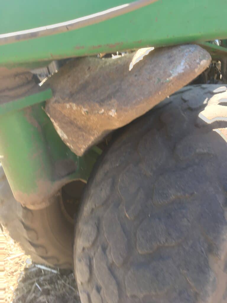
It’s not just combines. In rocky zones, planter disc openers are a frequent casualty. One pass through an unmapped high-density area can take out multiple row units simultaneously, right at the moment you need the planter running. For wheat and pulse operations across the Northern Plains and Canadian Prairies, drill disc openers face the same exposure. Tillage tools, tires, and hydraulic lines all carry risk in fields that haven’t been cleared.
Downtime Costs
The timing is what makes these events especially expensive. Purdue University Extension research shows corn yield potential drops up to 1% per day when planting is delayed past mid-May, and up to 1.2% per day after May 30. A planter down for five days in the last week of May isn’t just a repair bill. It’s yield potential that doesn’t come back. At harvest, the stakes are just as high: combines started earlier consistently outperform those rolling later, with research showing a meaningful per-acre yield advantage for timely corn harvest.
The Prevention Cost
Most operations run a crew through rocky fields in spring: walking, flagging, running a picker over bare ground. Evan Aardema, a farm manager with CSC Farms in Jerome, Idaho and a TerraClear customer, needed a six-person crew four full days to work through a 150-acre field the traditional way—24 man-days on a single field. At the 2024 national average field worker wage of $18.42 per hour, according to USDA NASS, that’s roughly $3,500 in labor alone, before fuel, equipment time, or anything else waiting on the other side of that window.
Missed Rocks: Future Costs
The deeper problem is that the effort itself has a ceiling. Traditional methods find what they can see. Rocks that are partially buried, the same color as bare soil, or just outside the path a crew walked don’t surface until they appear in a repair bill. You’re paying to prevent a problem you can’t fully see, every single season.
What Traditional Rock Scouting Can’t Solve
Traditional rock scouting methods share the same core limitation: they rely on what’s visible at ground level, in the conditions available, at the pace someone is moving. That’s not a crew problem or an effort problem. It’s a physics problem.
- Coverage is inconsistent by nature. Partially buried rocks, rocks in the corners you didn’t quite reach. Those stay in the field.
- The operational window is fixed. Traditional mechanical pickers require bare soil. Rocks that surface after tillage, or fields that couldn’t be reached before planting, carry through the season unaddressed.
- Nothing carries forward. Every spring starts from zero. There’s no record of where the high-density zones were last year, no way to prioritize which fields need the most attention, no way to improve coverage over time. You’re re-scouting the same ground with the same uncertainty, year after year.
How AI Rock Mapping Changes the Cost Equation
Traditional rock management works from the ground up: crews cover what they can see and pick from there. TerraClear flips that sequence. You know where every rock is before anyone or anything enters the field. That single change is what makes everything downstream faster, cheaper, and more complete.
Step 1 — Map It
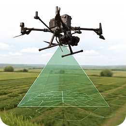
A drone flies your field, capturing imagery at 1.5mm Ground Sample Distance (GSD), fine enough to identify objects the size of a pencil eraser. TerraClear’s AI processes imagery and GPS-pinpoints every rock 8″ and larger across every acre. The result is a Rock Map: size, location, and an optimized pick route, delivered to the TerraClear app on your phone or tablet.
This is where the detection gap closes. Across TerraClear’s user base, the Rock Map identifies 3x more rocks than traditional scouting. The rocks your crew would have missed—partially buried, poor visibility, outside the path they walked—are on the map.
It’s the difference between looking across the field and looking down on it. Traditional scouting happens from ground level, where rocks can blend into soil, hide behind residue, or sit outside the path someone walked. Drone imagery gives TerraClear a top-down view of the entire field, making it easier to identify rocks that would be missed from the horizon-level perspective.
Step 2 — Pick It Smarter
The Rock Map works with whatever picking approach makes sense for your operation. Use your own equipment guided by the map, or book a rock picking crew who work directly from your map, picking to your spec.
The difference GPS-guided picking makes is significant. Jordan S., a Canadian farmer, completed a 273-acre field in 1.5 hours. The same field had previously taken six to seven hours with a traditional tractor pass. Across TerraClear’s user base, operations report up to 80% less time spent picking.
GPS-guided picking also removes the window constraint that limits traditional methods. It works post-plant in 30″ corn and soybean rows and in no-till fields without disturbing the seedbed. No bare-soil-dependent mechanical method can do that.
What Rock Mapping Costs — and What It Offsets
The Rock Map and picking are separate costs you can use independently or together. Mapping runs $3.95/acre USD MSRP. Rock picking service typically runs $8–$16/acre for a normal-density 160-acre field. All in, a mapped and cleared field runs $12–$20/acre.
| Cost item | Typical range |
| TerraClear Rock Map | $3.95/acre MSRP |
| Rock picking service (normal density) | $8–$16/acre |
| Mapped + picked, combined | ~$12–$20/acre |
| Annual rock-related equipment damage, medium-scale operation | $5,000–$25,000/yr |
| Crew-based picking labor, 150 acres (USDA 2024 avg. field worker wage) | ~$3,500 |
Mapping 500 acres costs less than $2,000. For most operations sitting in that $5,000–$25,000 annual damage range, knowing where your rocks are—and removing more of them—significantly reduces the exposure that drives those costs.
This is most compelling in fields with real rock density. In low-density operations where rock events are rare, the numbers will look different. The goal is fields that run cleaner and equipment that stays running longer, not a guarantee that rocks will never cause a problem.
Running the Math on Your Own Operation
The inputs are straightforward. Pull two or three seasons of repair invoices and flag anything involving rock ingestion, planter disc damage, or tillage tool failure. Add your picking labor at your local rate. Stack that against $3.95/acre MSRP for a Rock Map. For most operations with moderate to high rock density, that figure closes faster than expected, and improves in year two when the highest-density zones are already cleared.
Ready to Know What’s in Your Fields?
You know what rocks cost. See what a smarter approach looks like for your operation.
Get a Rock Map for your fields.
Questions about coverage or pricing?
The Rock Map is priced at $3.95/acre USD ($5.50 CAD) MSRP. Volume discounts are available for larger acreage orders, including maps for both rocks and weeds. Contact TerraClear at [email protected] or 425-274-2905.
By identifying rocks 8″ and larger before a crew or picker enters the field, the Rock Map eliminates redundant passes and the coverage gaps that drive up labor cost in traditional operations. One operator working from a map consistently outperforms a multi-person crew: fewer passes, less fuel, less time per acre.
In combines, rocks most commonly damage the feeder house chain, stone trap, threshing cylinder, concaves, and rotor elements. In row crop planters, disc openers are the primary exposure point. A single pass through an unmapped high-density zone can affect multiple row units simultaneously. Drills used for wheat and pulse crops face the same risk. Tillage tools, tires, and hydraulic lines also carry exposure in rock-heavy acres.
TerraClear flies your field after your order is placed. Once imagery is processed, your Rock Map is available immediately in the TerraClear mobile app (iOS and Android) and you’ll be notified. Timelines vary by season and region. Spring is the busiest window, so ordering early is recommended.
Yes. The Rock Map works with any picking equipment: the TerraClear TC100, skid steer attachments from other manufacturers, or hand picking crews. The map guides the operator. It doesn’t require TerraClear machinery to function.
TerraClear’s AI processes imagery at 1.5mm GSD, fine enough to identify objects the size of a pencil eraser. Across TerraClear’s user base, the system identifies 3x more rocks than traditional scouting methods. Manual scouting accuracy varies with field conditions, visibility, and crew pace.

Charles Stover is a Marketing Manager at TerraClear. His marketing career spans 20+ years in broadcast, healthcare, SaaS, and ag tech, with a focus on building and executing award-winning, data-driven campaigns. He’s a University of Oregon School of Journalism grad, a girl dad, and a lifelong Ducks fan. Find him at Charles-Stover.com or on LinkedIn