TerraClear Rock Maps
Reduce Rock Picking Costs By $20 per Acre


What does rock picking really cost you?
Rocks are a real input cost. They cost you time, money, and equipment wear every spring. Now there’s a way you can reduce that cost by picking rocks faster and cleaner than ever before.
Save Time & Money with a Rock Map

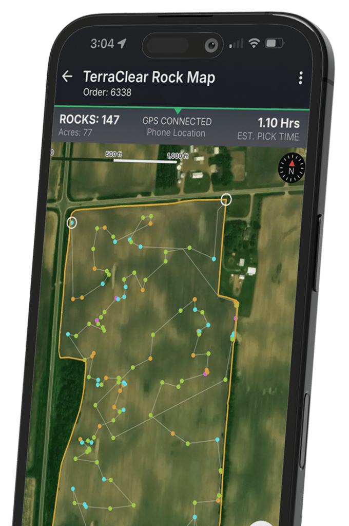
Map rock sizes and locations in your field

Create an efficient route for picking

Track your progress in real-time

Pick your field in 1/3 of the time

Reduce rock picking cost by up to $20/acre
How It Works
Three easy steps to map your acres. Secure your spring mapping window before demand peaks.

Schedule your Rock Mapping ahead of spring.

TerraClear maps your fields when conditions are right.

Receive your Rock Map to pick your fields 3x faster.
Plan Early and Save 5%
Submit your field boundaries by March 1, 2026 and receive 5% off rock maps and services. Planning ahead helps secure spring availability, and lowers the cost of rock picking when timing matters most.

“The Rock Map has just made rock picking for us so much easier, because it takes less time so we can get across more acres per day.”
Kyle O. | Iowa Farmer
Hurry, spring mapping slots are filling fast.
Lock in your acres now to secure spring mapping.