GPS Options for Rock Map Users
GPS isn’t one-size-fits-all for finding rocks
TerraClear Rock Maps use precision RTK to detect and mark rocks 8″ and larger, however your device’s GPS source determines how easily you can locate them in the field. After testing multiple options, we know the right GPS makes the difference between frustration and efficiency.
For guidance on GPS solutions:
- Contact your TerraClear rep
- Call Customer Support at 425-274-2905
1 Geode 10Hz+ requires a multi-frequency upgrade subscription
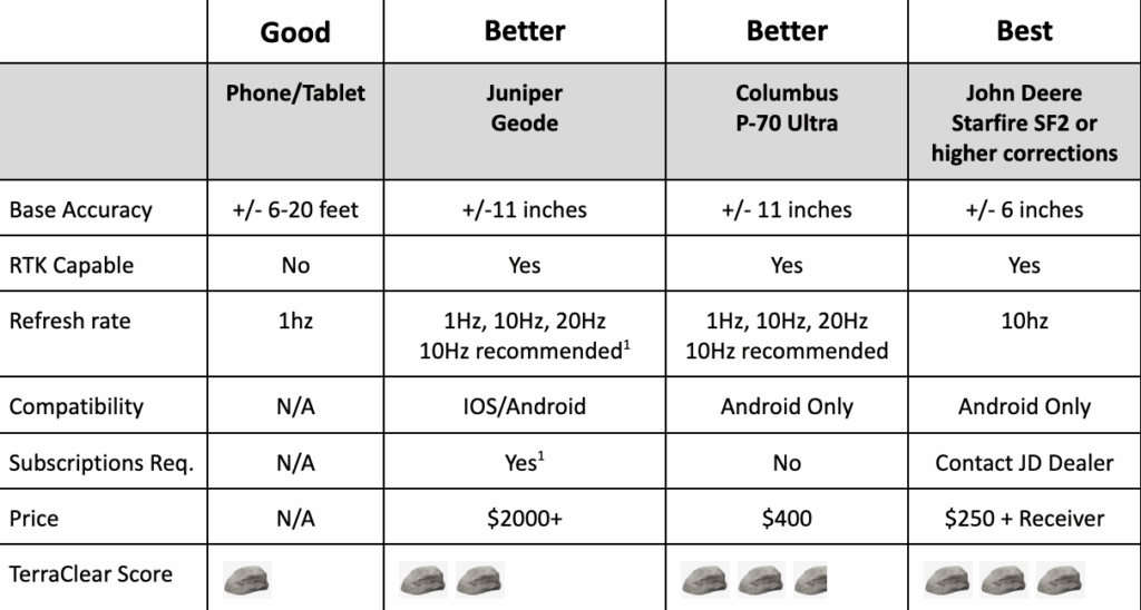
TerraClear-Approved GPS Solutions: Good, Better, Best for Every Field
Good: Phone/Tablet
Expect good to poor gps quality (acceptable in low residue with sparse rock density)
- Varying GPS accuracy based on phone/tablet and other variable
- +/- 6-20 feet
- May notice lag or latency issues depending on model and available cell service

Better: Juniper Geode GNS3M w/ 10hz or 20hz refresh
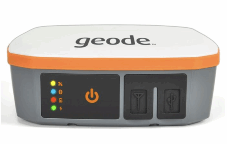
Works with iOS devices and can be upgraded to multi-frequency to achieve desired performance in field
- High quality gps (requires upgrades and subscriptions)
- Single frequency = +/- 11” / sub-inch with RTK subscription
- All day battery life
- Simple magnetic mounting makes moving to different machines a breeze
- Available for iOS and Android devices
Requirements:
- Ensure TerraClear Mobile is updated to Version 3.4.0 or greater
- Parts: Geode GNS3S or GNS3M (contact Juniper for specific upgrade options)
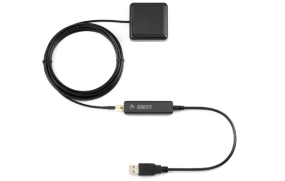
Better: Columbus P-70 Ultra Bluetooth Receiver
Great experience in most field conditions
- High quality gps with no fees or subscriptions
- +/-11” standalone / sub-inch in RTK mode
- Minimal latency when picking when switched to 10hz
- Simple magnetic mounting makes moving to different machines a breeze
- Only available for Android phones and tablets (not compatible with iOS )
Requirements:
- Ensure TerraClear Mobile is updated to Version 3.4.0 or greater
- Parts: Columbus P-70 Ultra Receiver
Best: JD Starfire 3000/6000/7000 w/ SF2 or greater
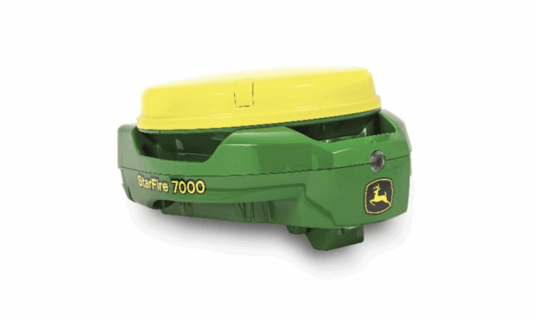
Best experience in all field conditions (recommended for all field conditions)
- Maintains consistent and repeatable GPS precision when in the field
- +/- 6” to sub-inch w/ RTK
- No latency when picking
- Excellent direction change when working in dense fields
- Only available for Android phones and tablets (not compatible with iOS )
Requirements:
- Ensure TerraClear Mobile is updated to Version 3.4.0 or greater
- Mounting location and power for John Deere StarFire receiver
- Parts:
- Ag Express Harness – AE3070P using the following link
- Male (female screw thread) RS232 to USB-C adaptor – approved device or similar
- USB-C splitter to enable charging tablet and receiver input – approved device or similar
Rock Map FAQs
TerraClear’s Rock Map gives you the ability to know where those frustrating rocks are in your field before they become a problem. The Rock Map shows you the size and location of each rock and tracks your progress as you pick them, making you more efficient at getting the job done. Another benefit of the Rock Map is that it increases your picking window because you know the exact location of the rocks in your field. This means you can even pick efficiently post-planting, when often rocks are harder to spot. Learn more about TerraClear’s rock mapping and end-to-end solution here.
The Rock Map starts at $4.50 per acre. Significant volume and early ordering discounts are available.
We know you’re going to appreciate the efficiency that the Rock Map adds to your picking operation, but if you aren’t happy with your map after using it, we will refund your money.
To generate the map, we fly your fields with a drone and capture high-resolution imagery. The images are then processed using artificial intelligence to pinpoint the location and the size of rocks that are 8" and larger. The map is delivered to you on our easy-to-use TerraClear app (Android or iOS), which not only shows you where the rocks are located, but using GPS it guides you along the most efficient route and tracks your progress.
The TerraClear Rock Map can be generated on many field conditions but is most accurate when done on cultivated-bare soil fields, early growth pastures, low emergence seeded fields, and medium to low residue or stubble fields. The bottom line is that if the rocks are visible, TerraClear’s Rock Map will work. Learn more about our Rock Map here or email us at [email protected].
The location accuracy of rocks on the Rock Map is less than 50cm. Accuracy using the map in the field to locate rocks is dependent upon your device. Most farmers are successful using the native GPS on their mobile devices (iOS or Android). Learn more about TerraClear’s Rock Mapping Service here.
We deliver every rock map through TerraClear’s easy-to-use mobile app (Android and iOS). Once we’ve processed your map, we notify you and provide instructions on how to access it.
TerraClear’s Rock Map is easy to use and does not require special equipment. To view and use the Rock Map, you will need an Android phone, iPhone, or tablet with GPS. To increase the accuracy, an affordable GPS-boosting device can be used. Contact us here for more information regarding devices and equipment compatible with TerraClear Rock Maps.
Once you’re notified that the Rock Map is available to you via the TerraClear Mobile app, you will see exactly where those troublesome rocks are. By enabling GPS and activating “pick mode” in the app, you are presented with an optimal path to guide you through the field. All rocks within your path are automatically marked as picked as you travel from rock to rock.
Currently, mapping is only available through TerraClear.