


Rock Mapping for Row Crop Farms
Find more rocks. Pick in less time.
We fly your fields, pin the rocks we find with a photo of each one, and hand your crew a route straight to them. No more working the field hoping to spot one before the header does.
Map My Acres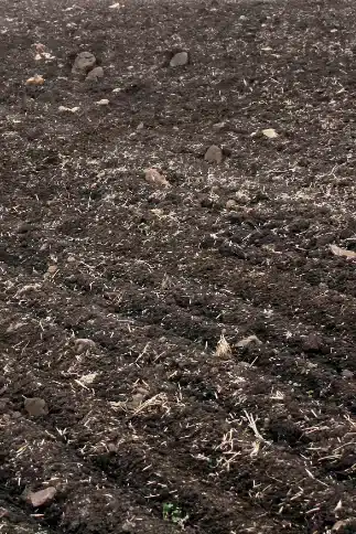
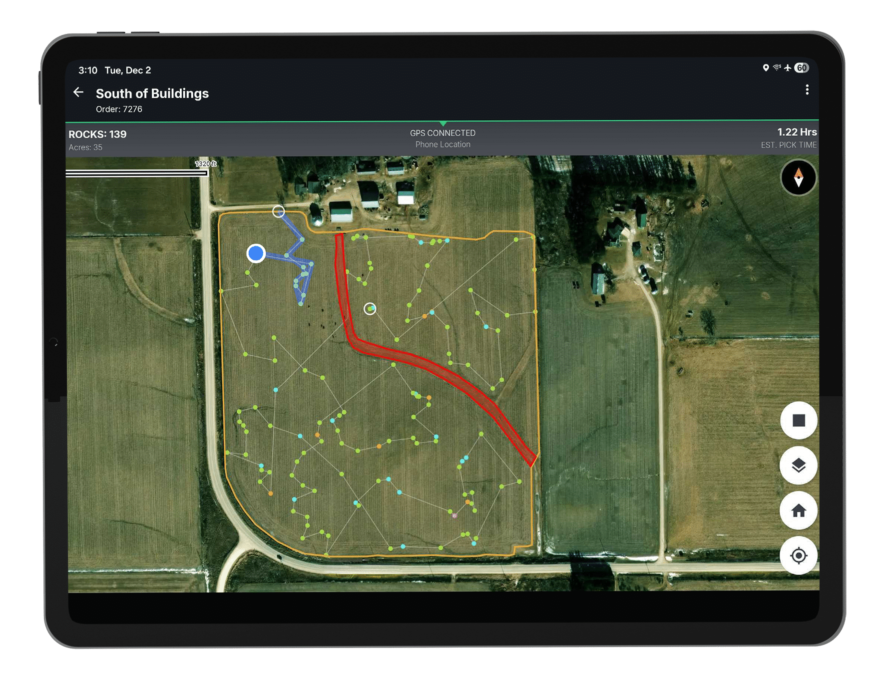
Satellite view of a field outlined in gold, with colored dots marking mapped rocks and a highlighted red area in the lower field. A white route line starts at the top of the field and winds down through the field, connecting the marked rocks.
A map of your field, rock by rock
A TerraClear rock map puts a pin on each rock our system detects at 8 inches and larger, across the whole field rather than a sample of it. Tap a pin and you see the actual photo of that rock, so you know what you are driving toward before you get there.
From above, a rock and a dirt clod stop looking the same
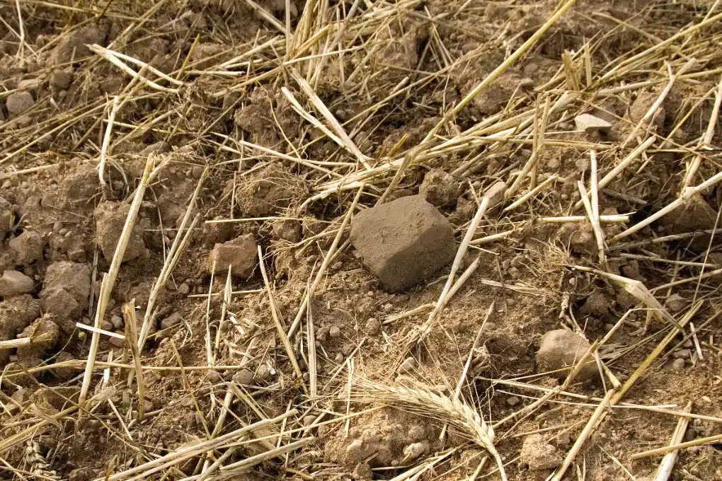
You can spot rocks from the ground. You do it every season.
What is hard is spotting them consistently, across every acre, while you are moving. A rock against a clod or sitting down in stubble reads as ground at working speed.
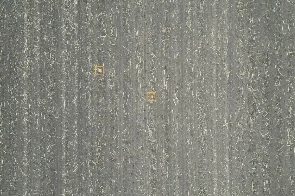
From above, every acre gets looked at the same way.
Our AI is trained on millions of rock images to tell rock from soil, residue and clods rather than guess at a shape. That is how you map what you can’t see.
Less time hunting. More ground covered. Fewer people needed.
Right now a pass means spotting a rock, driving over, climbing down, then scanning for the next one and doing it again. Most of the time goes into looking and repositioning, not picking. A map turns that into a route.
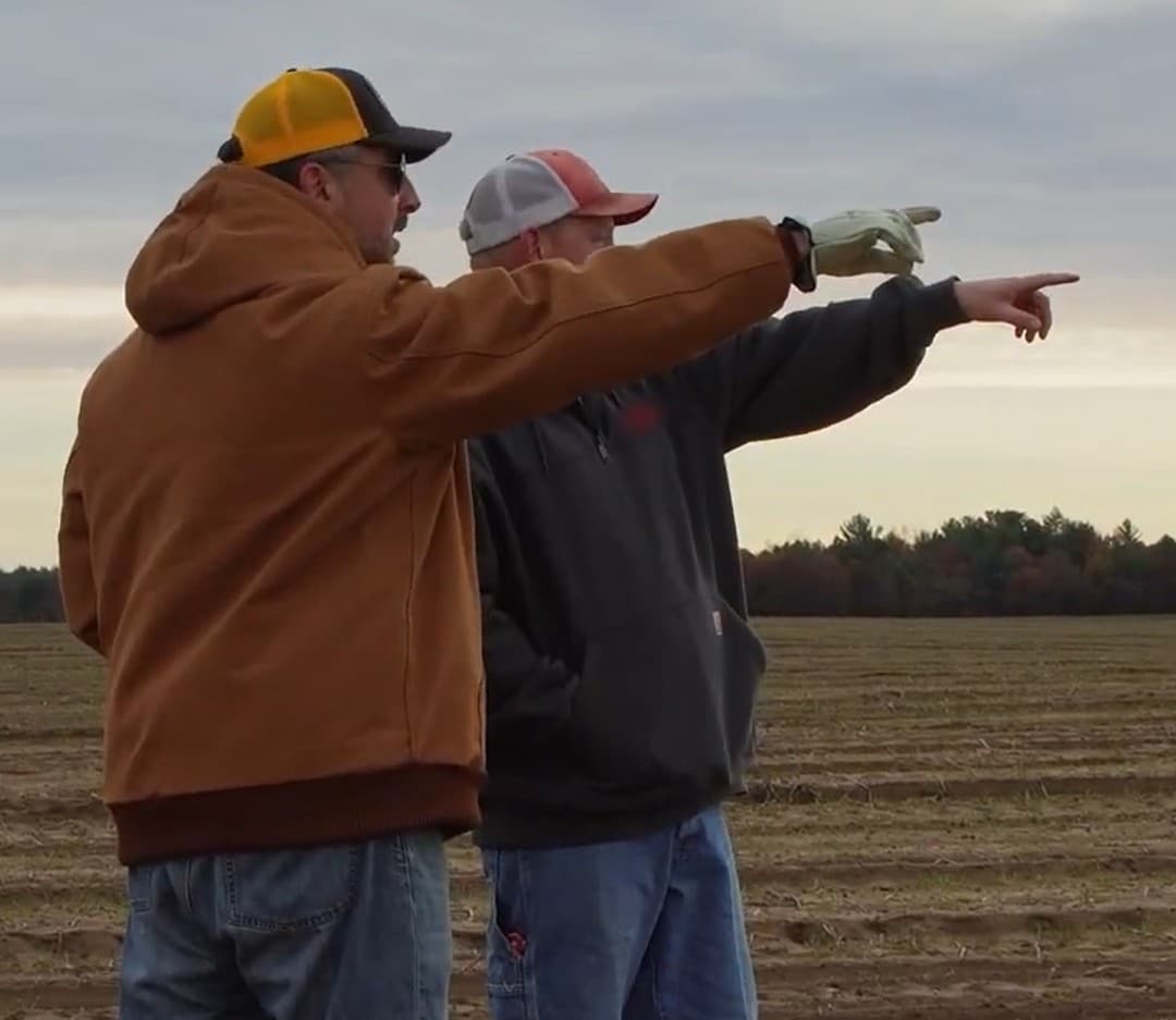
Find what gets missed
High-resolution detection separates rock from clods and residue that fool the eye.
Know which fields to hit first
See rock counts across your mapped fields and put your time where the problem actually is.
Drive a route, not a search pattern
GPS guidance takes you rock to rock, so you cover the ground once instead of doubling back.
See the sizes you care about
Filter to the sizes that threaten what you are running this week and leave the rest.
Put anyone in the seat
Share the map and a new hire can run the field without your knowledge of the ground.
Keep tabs from anywhere
Rocks get marked picked as they come out, so you can see progress without driving out.
From imagery to action in four steps
- 01
We fly your fields.
High-resolution imagery, down to 3 mm GSD.
- 02
Our AI finds the rocks.
Trained on millions of rock images, down to 8 inches, even in stubble and residue.
- 03
Your map is back the next day.
Aerial Edge Processing builds it in the field, not in a data center, so nothing waits on an upload.
- 04
You pick, and you can see it got done.
Follow the route and mark each rock as it comes out, so you always know what is left.
Specifications
- Detection
- Rocks 8 inches and larger
- Resolution
- Up to 3 mm GSD
- Location accuracy
- Centimeter-level GPS
- Capture rate
- Up to 1,000 acres per day
- Turnaround
- Map back the next day, on average
- Coverage
- Whole field, not sampled
- Crops
- Corn, soybeans, wheat and canola
- Output
- GPS pins, rock photos, pick route
- Field conditions
- Stubble, residue and emerged crop
- Season
- Year round, wherever rocks are not covered
- Devices
- iOS and Android
- We provide
- The flight, the detection, the map
- Picking
- Rock picker, crew, on foot or a service provider, each on an optimized route
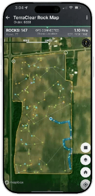
Built for the field
- Filter by rock size
- See the size you care about and hide the rest.
- Real rock photos
- Tap any pin and see the actual photo of that rock.
- Smart route guidance
- Move straight from one rock to the next.
- Mark picked
- Mark a rock as it comes out and keep a running record.
- Live tracking
- Watch covered ground and picked rocks fill in.
- Custom start and end
- Routes begin and end where you want them to.
- Live position and heading
- Know where you are and which way you are facing.
- External GPS support
- Connect a third-party device for more accuracy.


The map works however you pick
We find the rocks and show you exactly where they are.
The picking fits whatever you already run.
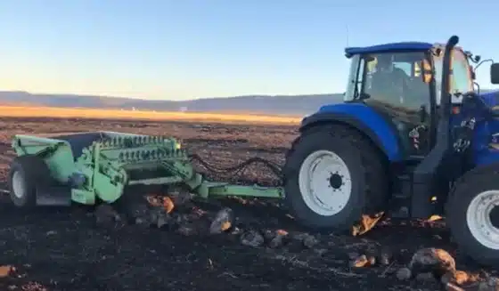
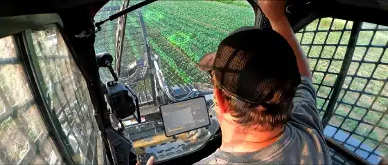
With a rock picker
Turn a machine you already own into a planned pass instead of a sweep.
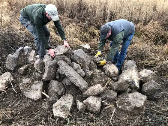
With a crew
Everyone works the same map and the same route, and you can see the progress.
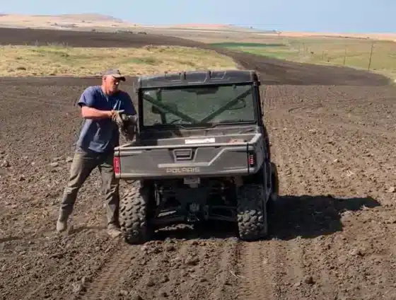
Walking the ground
Follow the pins and stop covering acres that have nothing in them.
With a service provider
Share the map so they quote and pick against real rock counts.
Save $20 an acre on rock picking costs
Rock work costs you in hours, labor, and repairs, tracked or not. Rock damage runs $5,000 to $25,000 a year for a mid-size operation, and repair costs are up 41% since 2020. A TerraClear Rock Map cuts out the searching, which is where the hours go.
Less hours
Up to 80% less time spent picking.
Less labor
A route and a shared map let a smaller crew cover the same acres.
Fewer surprises
The rock you never found is the one that costs the most.
The questions we get
Fair questions, answered straight.
My kid can do it.
If you have the help, a map makes that help go further. It gives them a route instead of a field, and rocks get marked picked as they come out, so you can see the job without going out to check it.
I already know where my rocks are.
You know where the bad spots are, and you are probably right about them. What a map shows is the rest of the field. Across fields we have mapped, growers find 3x more rocks than they were picking, and the difference is almost never in the spots they already knew about.
I just look for the rocks and go pick them. I do not need GPS.
That works for the ones you can see. A rock down in stubble or against a clod reads as ground at working speed. The pin is not there to help you drive. It is there to tell you a rock is ahead of you that you would have gone past.
My field has too many rocks for this to help.
Heavy ground is where the size filter earns its keep. Map it, set the map to the rocks that threaten what you are running, and clear the rocks that are an immediate threat of equipment damage.
Why pay for a map when I still have to pick the rocks myself?
Because picking was never the slow part. The searching is where the hours go: scanning, driving over, climbing down, then looking for the next one. The map does the searching before you get there, so the time you spend in the field goes into picking.
The rocks come back every year anyway.
They do. Frost and tillage bring up a new crop of rock every season, which is exactly why a map is worth having every season. It is the scouting pass on this year’s rock, not a one-time fix.
Growers who stopped guessing
“Seeing every rock—its size, location, and density—laid out with precision gave me clarity I’d never had before. Instead of guessing or making multiple passes, I could watch the process unfold in real time and understand exactly what needed to be picked. It turned rock picking into a strategic, data‑driven operation.”

“The efficiency gains are undeniable: fields that used to take us two full days to pick are now finished in just a few hours. We now have confidence in our thoroughness, and because we fly the drone ourselves, the data is ready when our schedule allows.”

“Labor savings is huge. We took our crew of 9 people down to 1 person. And it took just 1 week [versus] two weeks before.”

“TerraClear is a game changer for picking rocks. Once your field has been mapped, anyone can go efficiently and confidently clear the field.”

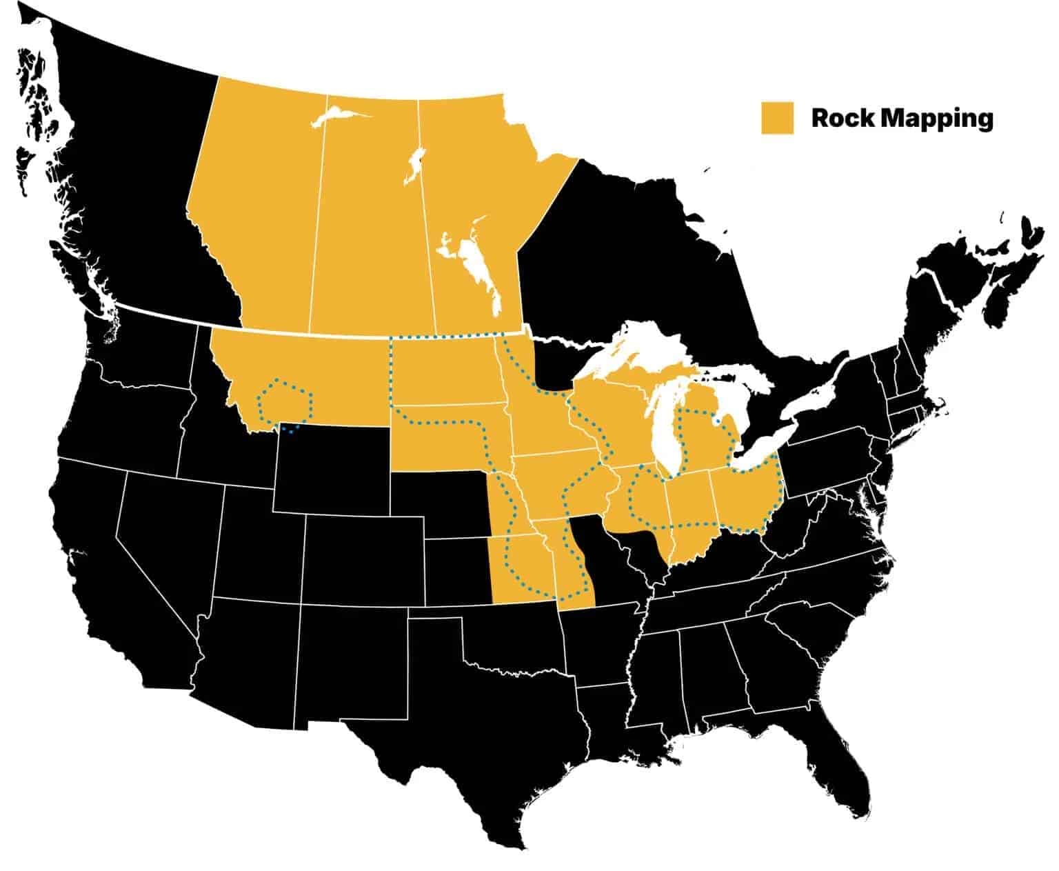
Where we map fields
TerraClear maps fields across Ohio, Iowa, Michigan, Illinois, Indiana, Minnesota, Kansas, Missouri, Wisconsin, North Dakota, Montana, South Dakota and Nebraska, plus Alberta, Saskatchewan, and Manitoba. If your ground is outside the area shown, tell us where you farm and we will let you know when we can get there.
Find more rocks. Pick in less time.
Tell us about your fields and we will take it from there.
- 01Tell us your fields. Acres and location.
- 02We schedule the flight around your conditions.
- 03Your map is in the TerraClear app on your phone the next day.
- 04You pick, or you share it with a provider.
Don't Want to Pick It Yourself?
If you have received your TerraClear Rock Map and don’t want to remove the rocks yourself, check out these independent service providers.
While TerraClear does not provide rock removal in-house, we have a selection of independent service providers who are ready to help with your rock picking!
Reach out to a service provider using the provided contact info and offer to share your Rock Map. The service provider will then provide you with a quote, utilize your rock map to pick efficiently, and invoice you directly
* Equipment type may vary by service provider
Connect with TerraClear
Frequently Asked Questions
TerraClear captures high-resolution aerial imagery over your fields, then use AI and computer vision trained on millions of rock images to detect and map pickable rock down to 8 inches with centimeter-level GPS accuracy.
TerraClear reliably detects and maps rocks 8 inches and larger.
Rock mapping works year round, anywhere rocks are not covered. Residue and dirt clods make rocks harder to pick out, not easier, which is what the detection is built to handle. The reason growers move in fall is the picking window, not visibility: once the ground freezes or snow arrives, the picking stops whether or not you know where the rocks are.
Our system works wherever rocks are visible from above, including fields with stubble, residue, or emerged crops.
Freeze and thaw cycles push rock upward through the soil profile over winter, and tillage brings more to the surface. That is why a field you cleared last season has new rock in it this season. It is not rock you missed, it is rock that was not at the surface yet. Most growers map annually for this reason.
It varies enormously by soil type, glacial history and how recently the ground was worked, which is why most growers have no reliable number for their own fields. That is part of what a rock map produces: a count, by size, for each field you map, so you can compare fields and decide where the work is worth doing first.
Most of the time goes into looking, not lifting. Without a map the pass is scanning, driving to what you spot, and repositioning. With a route built from a rock map you go from one marked rock to the next. Growers using TerraClear rock maps report spending up to 80% less time picking the same ground.
Every pin on a TerraClear rock map carries the actual photo our imagery captured of that object, so you can look at it before you drive to it rather than finding out when you get there. That photo is the heck on the detection.
To preserve the integrity of your Rock Map, do not work the ground in any way from the time your field was flown until rock removal is completed.
Use the Share button to invite team members, and choose an Admin or User role for each.
Each independent service provider sets their own pricing. Factors include distance to the field, field size and rock quantity. Discuss it directly with your provider.
They solve different problems and a lot of operations do both. Rolling presses rock down ahead of harvest so the header rides over it, which helps for that season and leaves the rock in the field. Mapping and picking takes the rock out, so it is not there next year either.
Most operations pile at the field edge, in a fence line, or in a low spot already out of production. Some crush and use them for approaches, and some sell larger stone to landscapers. Plan where the rock goes before you start the pass, because handling it twice is what makes the job long.
Does this work on no-till ground?
Yes. TerraClear Rock Maps are built for working row crop and small grain fields, and that includes no-till. Heavy residue can hide smaller rocks from the drone camera. For the best results, fly after residue settles or before spring field work. Your map flags each rock it detects at a precise GPS location, sorted by size, so you can decide what’s worth picking. If you’re not sure your residue level suits a flight, ask your rep before you schedule.
Yes. TerraClear Mobile gets your position from GPS, and GPS doesn’t need a cell signal.
Where the GPS fix comes from depends on your setup. If you pair an external receiver, the receiver handles positioning. That means a Wi-Fi-only tablet works and you can skip the hotspot. Without a receiver, your tablet needs its own GPS chip. Cellular-capable tablets have one, but plenty of Wi-Fi-only models don’t, so check the specs on yours. Even with a built-in chip, you don’t need a hotspot for positioning. For more information on GPS options, visit https://www.terraclear.com/gps-for-rock-picking/
Cell service matters for sharing. When you have coverage or a hotspot, the app uploads your traveled path, picked rocks, and any tags every five minutes. That way others in your operation can watch progress as it happens. If nobody needs to follow along live, sync over Wi-Fi at the end of the day.