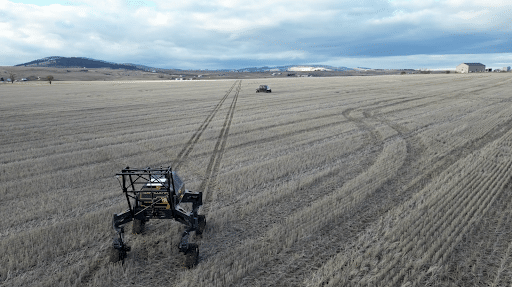
US ag-technology company TerraClear has introduced TerraScout, an autonomous field-scouting robot designed to collect ultra-high-resolution imagery and convert it into actionable agronomic insights across large row-crop farms. The platform is engineered to close the gap between field data collection and operational decisions, delivering real-time maps that can guide precision-agriculture actions such as targeted spraying or rock removal.
TerraScout captures imagery at 1 mm ground resolution, producing billions of image samples per acre while processing the data directly on the machine using onboard edge-computing systems. This enables the robot to generate actionable maps and prescriptions while still in the field, allowing farmers to respond quickly to emerging agronomic issues.
The robot can map more than 1,000 acres per day, travelling at speeds up to 15 mph with a 60-foot scanning swath, while operating autonomously for roughly six hours per cycle. Its AI models currently focus on identifying weeds and rocks, enabling growers to generate removal routes or targeted treatment plans for existing equipment fleets.
TerraClear, founded in 2017, has already mapped close to one million acres across more than 1,000 farms, originally focusing on rock detection before expanding into AI-driven weed management and field intelligence.
Bottom line: TerraScout illustrates a shift in precision agriculture from periodic imagery toward continuous, autonomous field intelligence — where robots collect plant-level data and immediately convert it into machine-ready prescriptions for farm operations.
Click here to read the full article.