TerraClear’s new autonomous field scout — TerraScout — was designed to help farmers scout fields for weeds and rocks with minimum labor. TerraScout can deliver ultra-high-resolution insights and real-time prescriptions, generating weed maps for over 1,000 acres a day and identifying 8-inch and larger rocks.
“This product is the evolution of what we do on the drone side today,” said Devin Lammers, CEO of TerraClear. “We’ve already mapped over a million acres with drones. One of the big limitations is on the compute side to produce output in real time. We’re collecting close to 100 acres an hour of millimeter resolution imagery. That is a massive amount of data. With powerful edge devices on drones, it takes a day or more of processing. The full front of the Terrascout is a dedicated computer. In literally real time, we can process the imagery into something usable.”
How a Drone Gave This Indiana Farmer More Control Over Fungicide Applications
Performance
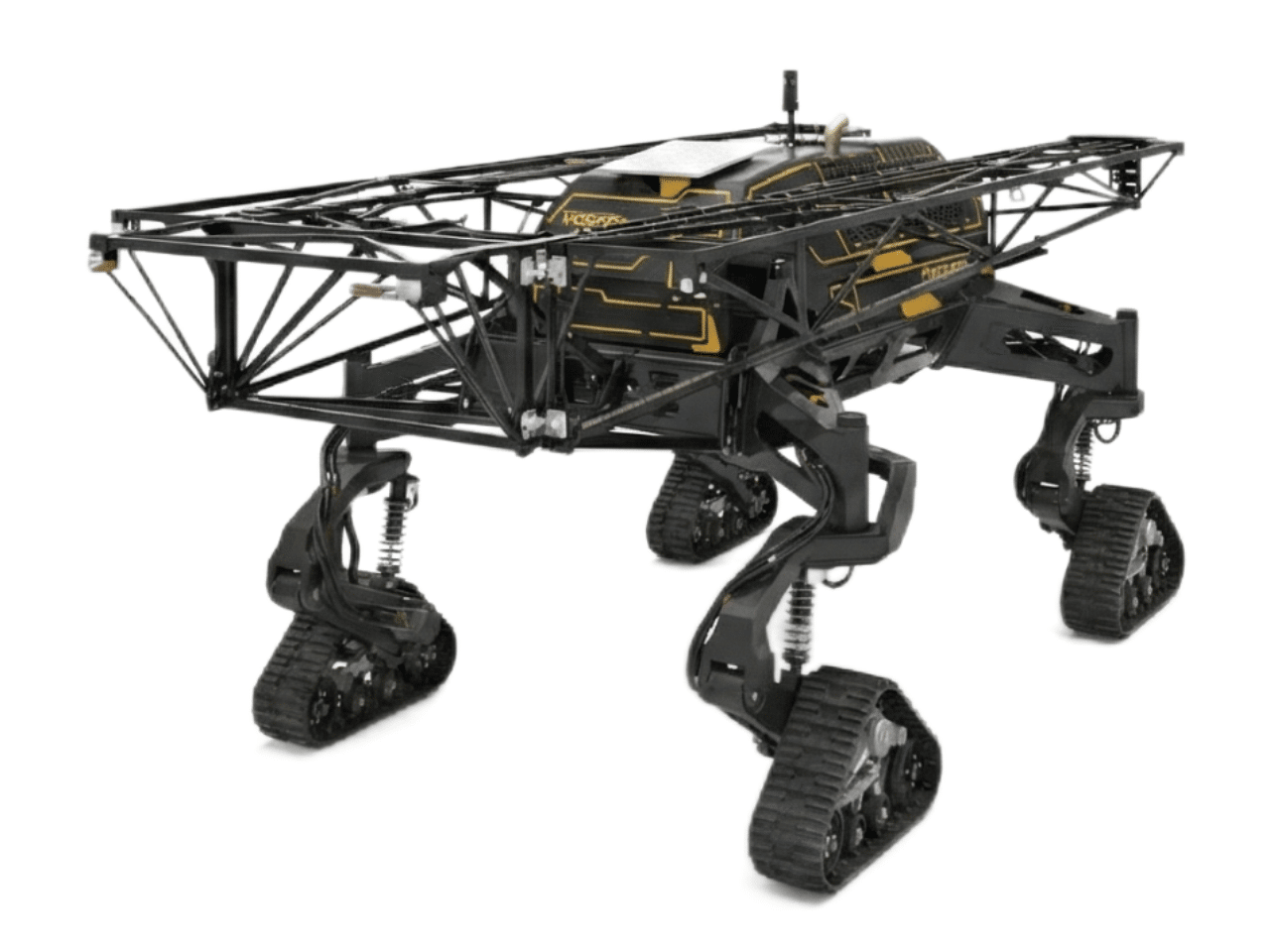
The TerraScout is powered by a diesel engine and uses mounted cameras to produce an image resolution up to 1 millimeter ground sampling distance (1 mm x 1 mm), day and night. This compares to drones that need sunlight and additional sensors to capture this level of resolution.
The system is Starlink capable for rapid transfer of data. Guidance relies on three levels of autonomy — GPS and two levels of perception that include object detection and row following.
At top speed, the 60-foot boom covers about 100 acres an hour. Slowing down for headland turns results in 80-plus acres per hour.
The TerraScout weighs in at 4,500 pounds and has an 8.5-foot transport width. The track system keeps ground pressure to 3 psi.
The autonomous field scout can be deployed any time a producer needs data to make informed decisions, such as accessing the impact of a drought.
The TerraScout is in field testing. Orders are expected to open this summer/fall and producers can put their name on a list at TerraClear.com.
Read the full article here